 Download
Unlock Mexico's Geological Secrets with GeoInfoMex!
GeoInfoMex, the premier geological consultation app, puts the power of geoscience at your fingertips. Explore the fascinating world beneath the surface of Mexico with access to a wealth of geological data.
This indispensable resource provides access to:
-
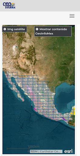
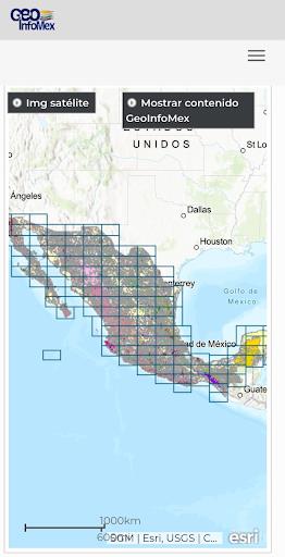
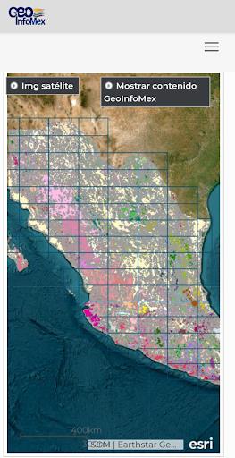
Extensive Geological Data: Dive into comprehensive geoscientific, geological-mining, and geophysical information for the entire Mexican Republic. Examine detailed maps and data related to mining activities, geophysical surveys, and geochemical analyses.
-
Mining and Rock Formations: Discover valuable insights into the location, characteristics, and other details of mines, beneficiation plants, and significant rock formations across Mexico.
-
Land Ownership Information: Access land ownership details for agrarian nuclei (ejidos) sourced from the National Agrarian Registry. Gain a clearer understanding of land boundaries and ownership patterns.
-
Protected Natural Areas: Explore information on protected natural areas managed by CONANP (National Commission of Natural Protected Areas). Ideal for eco-tourism enthusiasts and conservationists alike.
-
Real-Time Earthquake Monitoring: Stay informed about seismic activity with real-time earthquake data from reputable sources like SSN (National Seismic Service) and IG-UNAM (Institute of Geophysics at UNAM).
-
Hydrological Data: Access hydrological data from Cencas (presumably a sub-division of CNA, the National Water Commission), including water resources, river basins, and water quality information.
GeoInfoMex: Your Key to Understanding Mexico's Geology
Whether you're a geologist, researcher, environmental professional, or simply fascinated by Mexico's geological wonders, GeoInfoMex offers accurate, up-to-date information in a user-friendly format. Download GeoInfoMex today and embark on a geological adventure!